Key Highlights
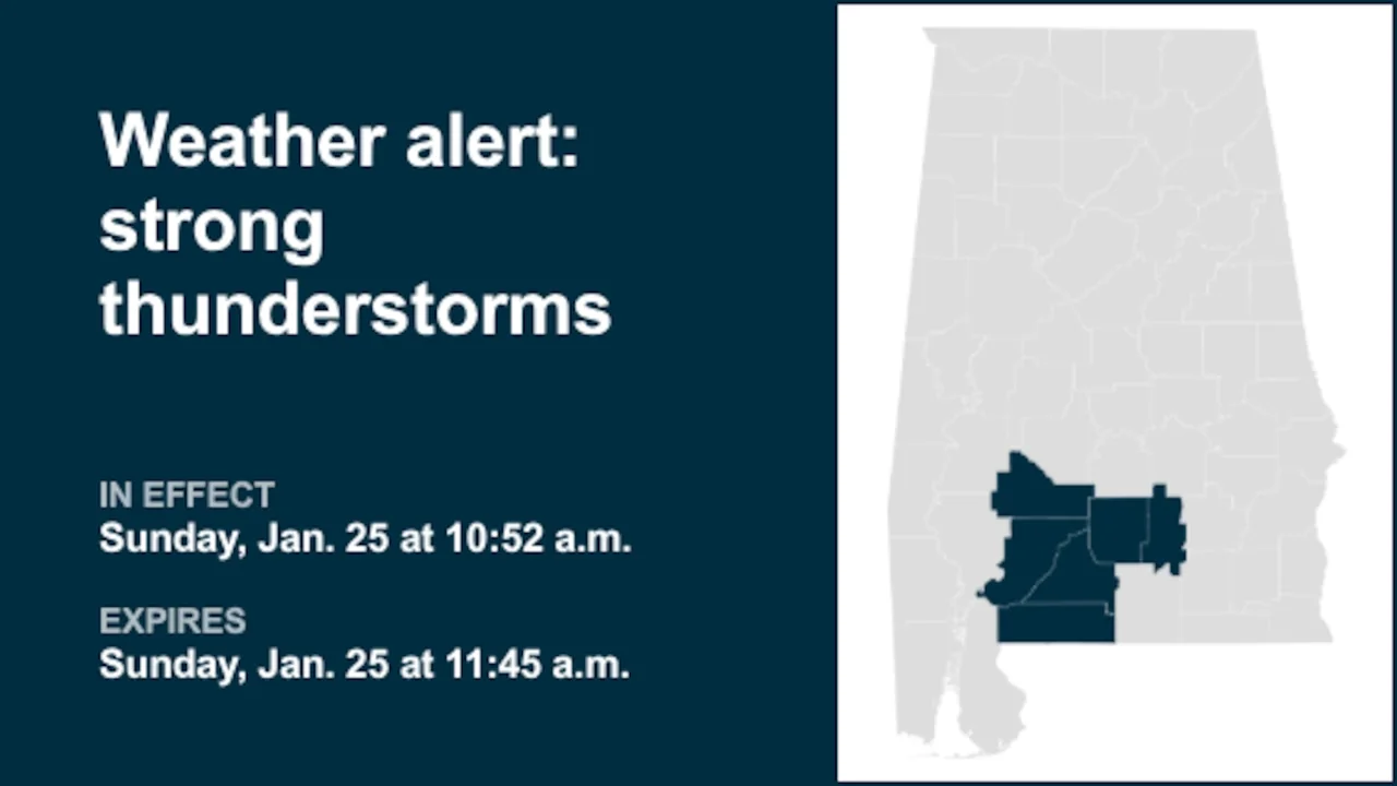
- The National Weather Service issued an updated report on Sunday at 10:52 a.m. for strong thunderstorms in specific Alabama counties.
- Residents are advised to prepare for wind gusts of up to 55 mph, which could knock down tree limbs and blow around unsecured objects.
- A Tornado Watch remains in effect until 6 p.m. for south central and southwestern Alabama and northwestern Florida.
Weather Alert Issued for Strong Thunderstorms in Southern Alabama Counties
The National Weather Service issued a significant weather alert on Sunday morning, warning of strong thunderstorms affecting several counties in southern Alabama. The updated report, which came into effect at 10:52 a.m., highlighted the potential dangers posed by these storms, particularly in Wilcox, Monroe, Conecuh, Butler, Crenshaw, and Escambia counties.
Preparedness for Residents
The weather service emphasized that residents should be prepared for wind gusts reaching up to 55 miles per hour. These high-speed winds can cause considerable damage by knocking down tree limbs and blowing around unsecured objects. The agency advised individuals to seek shelter indoors whenever possible, as outdoor activities during these conditions could pose significant risks.
Impact Areas
The alert covers a wide range of locations within the affected counties. These include areas such as Atmore, Greenville, Brewton, Evergreen, Flomaton, East Brewton, Georgiana, McKenzie, Castleberry, Repton, Pine Apple, Pollard, Riverview, Interstate 65 and US Highway 84, Interstate 65 and County Road 1, Interstate 65 and Alabama Route 113, and Interstate 65 and Alabama Route 21. Each of these areas is advised to stay alert for potential hazards.
Continued Vigilance Advised
The weather service also maintained a Tornado Watch until 6 p.m., indicating that conditions remain favorable for the development of tornadoes in south central and southwestern Alabama, as well as northwestern Florida. Residents are encouraged to monitor local radio stations and television channels for any additional information or possible warnings from the National Weather Service.
While the current weather alerts focus on the counties mentioned, residents across southern Alabama should remain vigilant and prepared for potential changes in weather conditions. The threat of lightning remains a critical concern during thunderstorms, with each year seeing approximately 25 million strikes in the United States, mostly occurring during summer months.
To enhance safety during thunderstorms, individuals are advised to have a comprehensive lightning safety plan.
This includes monitoring the sky for signs of storms and listening for thunder, which can indicate nearby lightning. Promptly seeking shelter indoors is crucial when thunder becomes audible. Indoor measures such as avoiding corded phones, electrical devices, plumbing fixtures, and windows or doors also help mitigate risks associated with electrical surges.
For those who find themselves outdoors without access to indoor shelter, the weather service recommends staying away from open fields, hilltops, and tall isolated trees.
Instead, individuals should seek lower-lying areas like valleys or ravines for better protection. Additionally, avoiding water bodies, wet objects, and metal items is essential as they can conduct electricity effectively and pose significant risks.
As thunderstorms draw nearer, the threat of lightning increases significantly. Therefore, it’s crucial to wait at least 30 minutes after the last lightning strike or thunderclap before resuming outdoor activities. This precaution helps reduce the likelihood of lightning-related incidents and ensures personal safety during severe weather events.
Navigating Heavy Rain: Essential Safety Measures
Beyond the immediate threat of strong thunderstorms, heavy rainfall poses additional hazards that require careful navigation. The weather service advises drivers to be particularly cautious on wet roads, as water pooling can significantly reduce traction and increase the risk of skidding.
Waterway Swell and Driving Safety
In heavy rain, it’s advisable to avoid parking or walking near culverts or drainage ditches. These areas can rapidly fill with swift-moving water, posing a significant danger. Drivers are encouraged to maintain safe driving distances by extending the traditional two-second following distance rule to at least four seconds under adverse conditions.
Enhancing Visibility and Safe Lane Choice
To enhance visibility during heavy rain, drivers should turn on their headlights and monitor for vehicles in blind spots due to rain-smeared windows. Slowing down gradually and avoiding abrupt braking are also essential measures to prevent skidding. Drivers are advised to choose middle lanes where water tends to pool less compared to the outside lanes.
Additional Safety Tips
The first half-hour of rainfall is particularly dangerous due to a mix of rain, grime, and oil on roads. During this period, drivers should exercise heightened caution. Additionally, maintaining emergency flashers can alert other drivers to your position when pulled over in the road.
By adhering to these safety measures, individuals can significantly reduce risks associated with heavy rainfall and ensure their well-being while traveling during stormy weather conditions. The National Weather Service advises staying informed about local weather forecasts and following advice from local authorities to make travel safe and sound during severe weather events.