Key Highlights
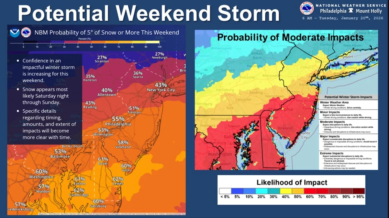
- The threat of a significant snowstorm hitting New Jersey this weekend has increased.
- The exact snowfall totals remain uncertain as the system is still developing.
- The storm is expected to develop near Texas on Friday and track up the East Coast toward New Jersey.
- Residents are advised to prepare for dangerously cold conditions with wind chills near or below zero degrees.
Potential Snowstorm on the Horizon
The National Weather Service has issued a warning that substantial snowfall is a possibility for New Jersey this weekend. According to meteorologists, there’s an increased likelihood of a significant winter storm developing in the region, but details about specific snowfall totals remain uncertain as of Tuesday.
Tracking the Storm System
Meteorologists are closely monitoring a storm system that’s expected to form near Texas on Friday and then move up the East Coast toward New Jersey. The mid-Atlantic region is currently situated on the northern side of this system, with the primary question being how close it will track to the state. AccuWeather.com reports that southern portions of New Jersey have a 40 to 60% chance of receiving six or more inches of snow, while areas south and west of Interstate 95 have a 60 to 70% chance of seeing at least two inches.
Chill Warnings and Hazardous Conditions
In addition to the potential for heavy snowfall, New Jersey residents should also prepare for dangerously cold conditions. A cold weather advisory is in effect until 10 a.m., with temperatures dropping into the single digits and teens overnight, leading to the formation of black ice on untreated road surfaces. Wind chills are expected to reach near or below zero degrees northwest of Interstate 95 and in central New Jersey, while other parts of the state can expect single-digit wind chills.
Temporary Break from the Cold
Before the potential snowstorm, temperatures will briefly moderate on Wednesday and Thursday. Highs are predicted to reach the 30s on Wednesday and the 40s on Thursday, providing a temporary respite from the bitter cold. However, another Arctic front is expected to move through late Thursday, bringing colder conditions with highs in the 20s and 30s and lows in the single digits and teens by Friday night.
Preparing for Winter’s Wrath
Residents are advised to wear appropriate layers of clothing if venturing outside, especially while traveling. The weather service emphasizes allowing extra time to reach destinations due to hazardous road conditions. High pressure is expected to move overhead on Tuesday night, leading to lighter winds and clear skies that will enable significant radiational cooling, producing widespread overnight lows in the single digits.
In conclusion, while forecasters continue to monitor the evolving storm system, New Jersey residents should remain vigilant and prepare for both potential snowfall and dangerously cold temperatures. The exact timing of the snowstorm is expected to be late Saturday through Sunday, with the possibility of lingering into Monday depending on the system’s speed.