Key Highlights
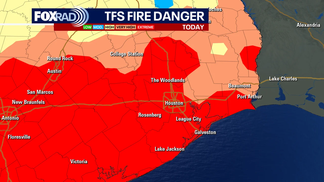
- A Red Flag warning is in effect for Southeast Texas until 6 p.m. Monday.
- The cold front will bring temperatures dipping into the low 40s and mid-to-upper 30s, with wind chills in the 20s and 30s.
- Outdoor fires are not recommended due to critical fire weather conditions.
- Frost is a possibility on chilly mornings following the cold front.
Houston Braces for Cold Snap and Fire Risk
Weather experts at FOX 26 Houston have issued a Red Flag warning until 6 p.m. Monday, as a cold front moves through Southeast Texas. This is the first significant weather alert in an area already facing persistent burn bans due to ongoing drought conditions.
Elevated Fire Weather Conditions
According to the National Weather Service, elevated fire weather conditions are expected for today and into Monday, with gusty northerly winds and drier air. This has prompted warnings from local authorities to avoid outdoor fires as they pose a high risk of rapid spread.
Cold Snap Looms
As the cold front approaches, Houstonians can expect temperatures to plummet into the low 40s by Monday morning and mid-to-upper 30s north of the city. Wind chills will make it feel much colder, with temperatures in the 20s and 30s.
Preparation Tips for Residents
The weather team advises residents to prepare for the cold snap by ensuring their children are well-bundled up at bus stops on Monday morning. Frost is a possibility during these chilly mornings, so local authorities recommend checking outdoor surfaces for ice or frost patches.
In addition to the Red Flag warning, FOX 26 Houston also noted that tropical cyclone activity in the Atlantic Basin is expected to wind down as the season nears its end, with no significant activity anticipated until next month.
The weather team emphasized the importance of staying informed about local conditions and following guidelines issued by fire departments and other relevant authorities. The forecast suggests a brief period of cooler temperatures before a quick rebound into warmer weather by mid-to-late next week.