Key Highlights
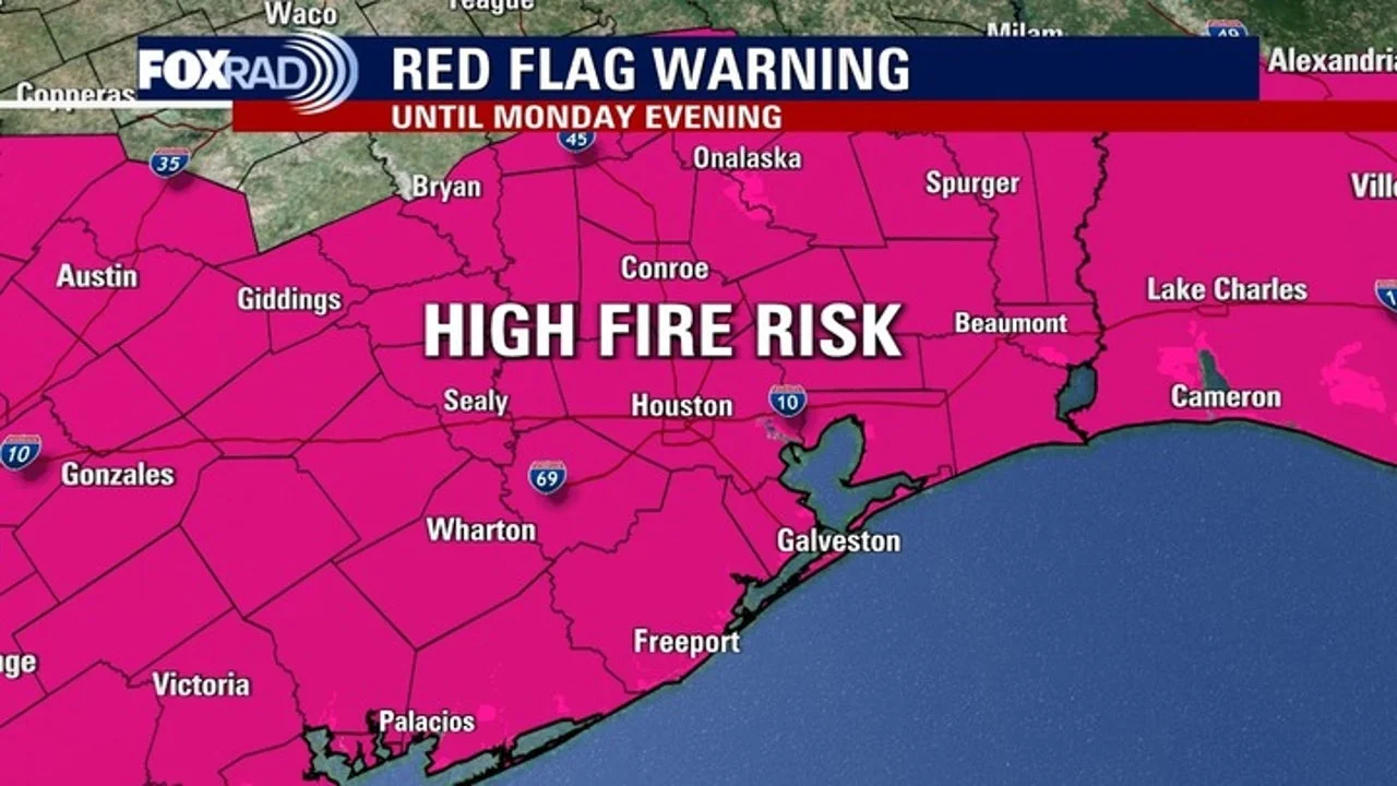
- Houston and Southeast Texas face critical fire weather conditions on Monday due to gusty northerly winds and dry air.
- A Freeze Warning is in effect for Polk, Trinity, and Walker Counties from 9pm Sunday to 9am Monday.
- Temperatures are expected to dip into the low 40s with mid-upper 30s north of Houston on both Monday and Tuesday mornings.
- No tropical cyclone activity is expected in the Gulf during the next week.
Houston Weather: Fire and Freeze Warnings for Southeast Texas
The weather forecast for Houston and Southeast Texas this weekend has taken a critical turn with fire and freeze warnings, signaling an unusual combination of severe conditions. The Red Flag Warning, issued by the National Weather Service, highlights elevated to critical fire weather conditions expected on Monday due to gusty northerly winds and dry air. Residents are advised that any fire starting under these conditions could spread very quickly.
The freeze warning is particularly concerning for regions including Polk, Trinity, and Walker Counties.
From 9pm Sunday to 9am Monday, temperatures will drop significantly, potentially leading to frost on the ground early in the morning. Meteorologists predict overnight lows will plummet into the low 40s with mid-upper 30s north of Houston. These conditions could pose a risk to outdoor plants and structures, urging residents to take necessary precautions.
The freeze warning adds another layer of concern for commuters on Monday, as temperatures are expected to feel like the 20s and 30s in the morning, prompting a reminder for parents to ensure their children are well-bundled up at bus stops.
The cold snap is described as the coldest air of the season so far, with temperatures not having been this low since February.
Despite the challenging weather conditions, there’s some relief on the horizon. A warm front will bring a return to 80-degree temperatures by mid-week, and it’s expected to persist into the weekend. This significant temperature swing is a stark contrast from the cold snap that has gripped the region this week.
Additionally, while tropical activity remains low in the Gulf of America for the next seven days, there are no imminent concerns about further development.
The National Hurricane Center reports that tropical cyclone formation is not expected during this period, offering some respite from those concerned about potential storms.
In conclusion, residents in Houston and Southeast Texas should prepare for these unusual weather conditions over the weekend, ensuring safety measures are in place to combat both fire risks and freezing temperatures. The region’s weather authority continues to monitor the situation closely, providing updates as necessary to keep the public informed and prepared.